Dave and Lisa White have been paddling around the Carolinas since 2007, and their dog Jovie joined them in 2024. Since 2007 they have had many paddle adventures outside the United States including The Galapagos, Essaouira (Morrocco), Paraty (South America), Brisbane (Australia), London, Sardinia (Italy), Turks and Caicos, and the British Virgin Islands. Inside the US they have paddled in North Carolina, South Carolina, Georgia, Florida, Virginia, Texas, Michigan, California, West Virginia, and the US Virgin Islands. They currently reside in Charlotte, North Carolina but also spend a lot of time in the coastal areas of the Carolinas. Dave and Lisa are also avid Paddle Logger users, which was why we were stoked to catch up with them about all things weather, tracking, and essentially – what it’s like to paddle in the Carolina’s!
Hi Dave and Lisa! We are so thrilled to have here! How do you typically use the Paddle Logger app during your paddling trips around the Carolinas in general?
Typically, we use the Paddle Logger app to track our time, distance and route when we paddle. Over the last few years we have loved having the ability to immediately see what the wind conditions are and when we are in the coastal Carolinas being able to see if we are in a rising or falling tide before planning our route.
What features of the Paddle Logger app do you find most helpful when exploring your local waterways?
Always start off every paddle looking at wind, weather, tides, time (duration of paddle) and possible water traffic for the paddle, and then of course always map out the route. Paddle Logger makes it so simple to quickly look at the most important and constantly changing variables (wind and tides) when in the Coastal Carolinas.
Can you walk us through your usual process of recording a paddling trip with the app and how you prepare with the Paddle Logger app before heading out on the water around the carolinas ?
We usually wake up, check the weather and then check Paddle Logger for wind and tides information. Once everything is a go we will travel to our launch spot, put our equipment in the water, load the dog on the board and I will click the Go button on Paddle Logger. I have a 55 second delay set up so I can put my phone in a waterproof case and then place that in a dry bag and attach it to the board’s bungee cords and then away we go!
That’s great! Have you noticed any particular benefits from using the app while paddling in the Carolinas?
Usually, we paddle as a pair or with a group butoccasionally one of us may go out solo. Then we will set up PaddleLIVE to let our contact know we are going to be out on the water, and this is an excellent additional safety option.This is especially true in the coastal areas because there are times you are completely removed from civilization, and this just provides an extra layer of comfort for everyone. Another vastly underrated option with Paddle Logger is the ability to track your goals for number of paddles, paddling distance and time on the water. I’ve found this to be an excellent motivator to get you out on the water if it may be one of those days where you are not sure if you want to get on the water (rare, but it happens lol).
Incredible! We love to hear it! How do you use the app to navigate or plan routes around your local waterways?
The app is extremely useful, especially if we are revisiting routes that we have traveled before. This is especially true in the coastal areas when differences in the tide can sometimes mean over 7 feet difference between high and low tide which may eliminate some of the common landmarks in a lower tide. And you certainly don’t want to get caught in the middle of a marsh while a tide is falling. A perfect example of this is during some of our marsh explorations – sometimes it is difficult to find where those cut throughs are but by referring to historical routes that we have captured via Paddle Logger it is much easier (and safer) to identify the appropriate passageways (see example below of a trip with two separate marsh shortcuts at mile marker 2 and 3.
Are there any challenges you’ve faced using Paddle Logger during your trips, and how do you handle them?
One challenge that my wife recently experienced was when she completed a charity 24 mile damtodam paddle in the Charlotte, NC area. This was a 10+ hour paddle so one concern was having enough battery power to last the entire trip, and fortunately that proved to be no problem. However, during one of the paddle breaks she accidentally paused the tracking on the Paddle Logger app. She was worried that this would stop the paddle tracking but somehow even though the tracking was paused for a few miles (13 through 16) the Paddle Logger app was still able to capture the entire paddle (still not sure how this worked but many thanks to the developers for their magic!). See to the right when the tracking was stopped between miles 13-16 but still captured the total mileage that was completed.
Wow! We’re happy to hear that Lisa didn’t lose any data on that paddle! How does the app enhance your safety or awareness while paddling in remote parts of the open ocean off the coast?
Like I mentioned the biggest benefits are using Paddle Logger app are to understand the wind conditions, the tidal chart and to be able to identify safe travel routes. One of the more dangerous elements in coastal waters are the oyster beds, especially at low tide.
Thanks for iterating that! How has using the Paddle Logger app changed or improved your paddling experience around the Carolinas?
The app has definitely become part of our regular routine, and we love the ability of the app to track time, distance, speed and of course the route. With the added functionality over the past few years, it is now invaluable to us to also be able to track the wind speed and when in coastal areas keep track of tide changes.
We love how much you love the app! Speaking of love – why do you love paddling around the Carolinas and what makes it so special as a place to paddle?
Probably the biggest advantage is the weather – we have been able to paddle as early as January 1st and as late as Thanksgiving weekend (last weekend in November). Also, there is a great variety of different types of paddling experiences. Near Charlotte is the Catawba River which offers up a number of different lakes from Lake James near the western NC mountains to Lake Wateree down in South Carolina and including Rhodiss Lake, Lake Hickory, Lake Lookout, Lake Norman, Mountain Island Lake, Lake Wylie, Fishing Creek Resevoir, and Stumpy Pond. Each of these offers a unique paddling experience. Of course, there are the coastal areas of the Carolinas which contain such a fascinating habitat of wildlife and additional paddling challenges.
Fantastic! What nature, wildlife do you see around the Carolinas?
In the lakes around Charlotte, NC we very commonly see blue herons, osprey, mallards, wood ducks, turtles and occasionally bald eagles. Down by the coast in Charleston, SC we see brown pelicans, egrets, oystercatchers, spoonbill, and gulls. But by far the main attraction is the dolphins which are plentiful, playful, and such a joy to observe.
That sounds incredible! Why should people come paddle around the Carolinas?
If you are looking for calm waters, serene nature and beautiful weather I would recommend the lakes in North and South Carolina. But if you are looking for more of a challenge and the opportunity to see dolphins and other wildlife up close then the coastal part of the Carolinas might be for you. There are definitely plenty of opportunities whether you prefer fresh or salt water and I don’t think you will be disappointed with either.
Thank you so much Dave for sharing your experiences with us using Paddle Logger around the Carolina’s! We hope you enjoy your next paddling adventure under the guidance and support of Paddle Logger!
Paddling across Italy’s diverse waterways requires preparation, awareness, and a deep connection with the environment. From the alpine beauty of Lake Garda to open-ocean sessions abroad, Nicola Volani relies on Paddle Logger to stay safe, track performance, and plan each adventure with confidence. In this interview, they share how the app has become an essential […]
Have you ever thought about paddling 78 miles in 48 hours!? Jeannie Johns, an ultra endurance stand up paddler from British Columbia, Canada, who will be participating in the famous ultra 70-48 race next month shares her enthusiastic experience with the Paddle Logger app. During her paddling adventures around Gabriola Island, she highlights how the […]
Paddle Logger, the most award winning paddling tracking app is excited to announce the launch of Season 3 of the Rise and Glide Podcast TODAY! As they embark on this new season, Paddle Logger continues their mission to explore the vibrant world of paddle sports, bringing you inspiring stories, expert insights, and the latest trends […]
Paddle Logger, the popular iOS app designed for paddlers, has announced the launch of French and German language support, further expanding its accessibility alongside English and Spanish. Now, even more paddlers can track their adventures and stay safe on the water in their native language. Already a go-to app for stand up paddle boarders, kayakers, […]
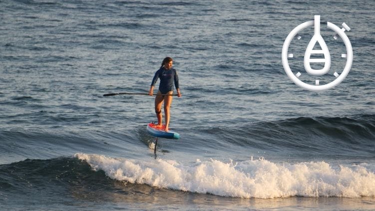
In the dynamic world of stand-up paddleboarding, Paddle Logger’s Holly Pye is carving her own path with passion and determination. With a love for the ocean and a spirit of adventure, she has embraced the challenges of SUP foiling, a sport that combines the thrill of gliding above the waves with the artistry of technique. […]
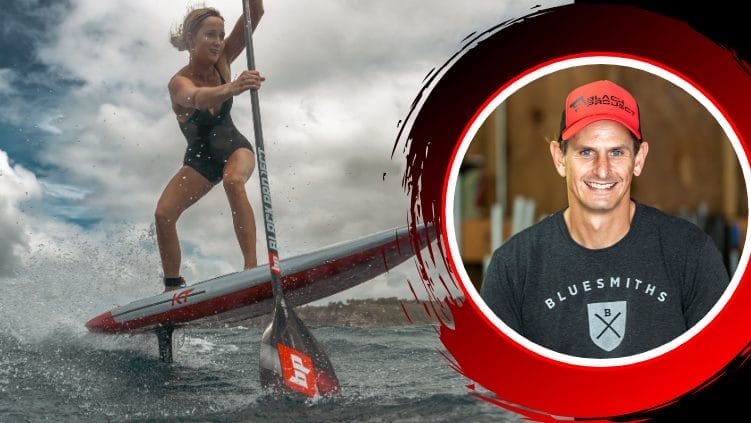
We’ve seen firsthand over the years what it takes to fuel the growth of SUP communities by raising the profile of the sport through high-calibre competitions that attract international athletes, while also keeping local talent engaged within the scene. This year, Chris Freeman, Co-Founder of Black Project, the Maui brand developing high-performance stand-up paddleboard fins […]
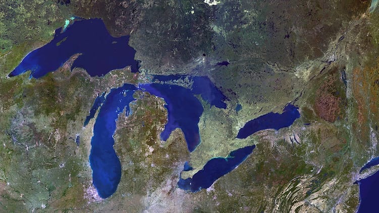
I have written a few articles this year about paddling in beautiful destinations like Southern California, and Florida. Paddling on the Great Lakes offers a unique blend of adventure, tranquility, and stunning natural beauty. I have grown up in between the Great Lakes my entire life (specifically Erie, and Ontario), and I am stoked to […]
Today on TotalSUP we are stoked to be the first to share the exciting news from our favourite GPS paddle tracking app! Paddle Logger is excited to announce the launch of PaddlePLAN, a game-changing new feature for iPhone and Apple Watch that helps paddlers to explore and plan routes, navigate while on the water, and […]
We cannot believe it has been ten years since the launch of one of the most used paddling tracking apps known as Paddle Logger. Today we welcome David Walker, the co-founder of Paddle Logger to TotalSUP. As a passionate paddler himself, Dave shares insights about the innovative app designed specifically for paddlesport enthusiasts, including stand-up […]